accurate map of solar radiation in France (France DNI)
published: 04/03/09, 12:56
Here animated map of France irradiation (DNI Direct Normal Irradiation = France) actual solar (based on satellite observations) in Fance for 2006:
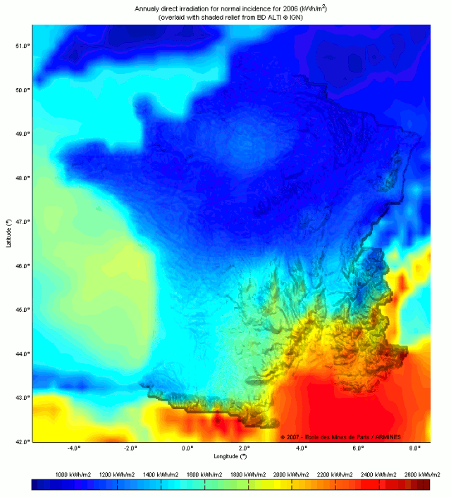
a) Average solar radiation in France on 2006 year in kWh / m².year:
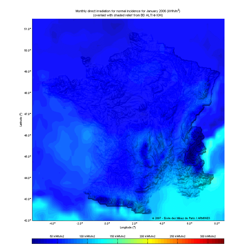
b) Solar radiation month by month in kWh / m².mois:
2ieme loading the card is a bit long because it is near 2 Mo.
Source: Copyright Ecole des Mines de Paris / Armines 2007
ps: the satellite method should give the IR radiation from the ground, notice the radiative forcage of the Parisian metropolis ...
Each map below represents the direct component of the monthly radiation received on a plane always facing the sun for 2006 year in kWh / m². There is one card per month as well as a map for the annual irradiation and animation for the year.
a) Average solar radiation in France on 2006 year in kWh / m².year:
b) Solar radiation month by month in kWh / m².mois:
2ieme loading the card is a bit long because it is near 2 Mo.
The maps were calculated from observations made by meteorological satellites according to Heliosat-2 method. The original data is stored in the HelioClim-2 database. Shading was added to maps to represent the relief.
Source: Copyright Ecole des Mines de Paris / Armines 2007
ps: the satellite method should give the IR radiation from the ground, notice the radiative forcage of the Parisian metropolis ...